Tetsujin
Members +
I figure I'd share my favourite low-level nav routes here. (The site https://fsxmap.com/ is great for exploring before flight.) Please post your own favourites below so I can try them out.
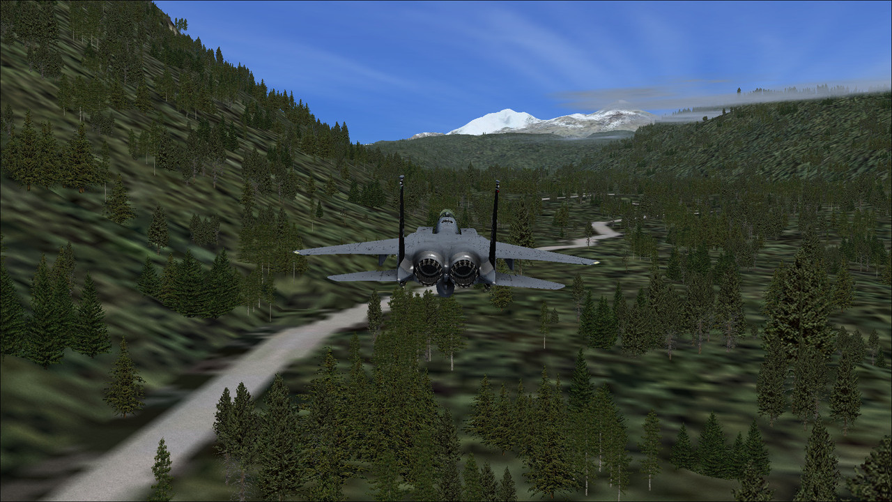
MACH LOOP
Llanbedr (EGOD) Rwy18 → Machynlleth → A489 → A470 → A487 → Machynlleth → Llanbedr (EGOD) Rwy36
LAKE DISTRICT (LFA17) WEST
Walney Island (EGNL) Rwy06 → Windermere → Thirlmere → Bassenthwaite Lake → Carlisle (EGNC) Rwy07
LAKE DISTRICT (LFA17) EAST
Walney Island (EGNL) Rwy06 → Windermere → Kirkstone Pass → Ullswater → Carlisle (EGNC) Rwy07
SCOTTISH LOCHS
Leuchars (EGQL) Rwy09 → Forfar → Braemar → Loch Tummel → Loch Rannoch → Loch Ericht → Loch Ness → Inverness (EGPE) → Kinloss (EGQK) → Lossiemouth (EGQS) Rwy05
SWISS ALPS
Basle-Mulhouse (LFSB) Rwy16 → Grenchen (LSZG) → Bern (LSZB) → Thun (LSZW) → Interlaken (LSMI) → Meiringen (LSMM) → Ulrichen (LSMC) → SS659 → E62 → Lago Maggiore → Malpensa (LIMC) Rwy35L
GRAND CANYON WEST
Nellis (KLSV) Rwy21L → Lake Las Vegas → Colorado River → Temple Bar (U30) → Peach Springs (1G4) → Grand Canyon → Grand Canyon National Park (KGCN) Rwy21
GRAND CANYON EAST
Grand Canyon National Park (KGCN) Rwy03 → Grand Canyon → Marble Canyon (L41) Rwy03
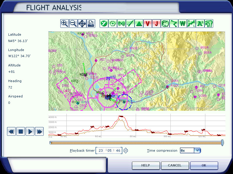
PORTLAND LOOP
Portland (KPDX) Rwy10L → Columbia River → Cascade Locks (KCZK) → Carson → Wind River Hwy → Swift Reservoir → Yale Lake → Lake Merwin → Woodland (W27) → Portland (KPDX) Rwy10R
SEATTLE I90
Seattle-Tacoma (KSEA) Rwy34R → I90 → Bandera (4W0) → Easton (KESW) → Cle Elum (S93) → De Vere (2W1) → Bowers (KELN) Rwy07
VANCOUVER WEST LOOP
Vancouver (CYVR) Rwy26L → Squamish (CYSE) → Pemberton (CYPS) → Lillooet Lake → Tipella (CBB7) → Harrison Lake → Chilliwack (CYCW) → Vancouver (CYVR) Rwy26R
VANCOUVER EAST LOOP
Chilliwack (CYCW) Rwy07 → Hope (CYHE) → Lytton (CYLY) → Lillooet (CAR3) → Seton Lake → Anderson Lake → Pemberton (CYPS) → Lillooet Lake → Tipella (CBBY) → Harrison Lake → Chilliwack (CYCW) Rwy07
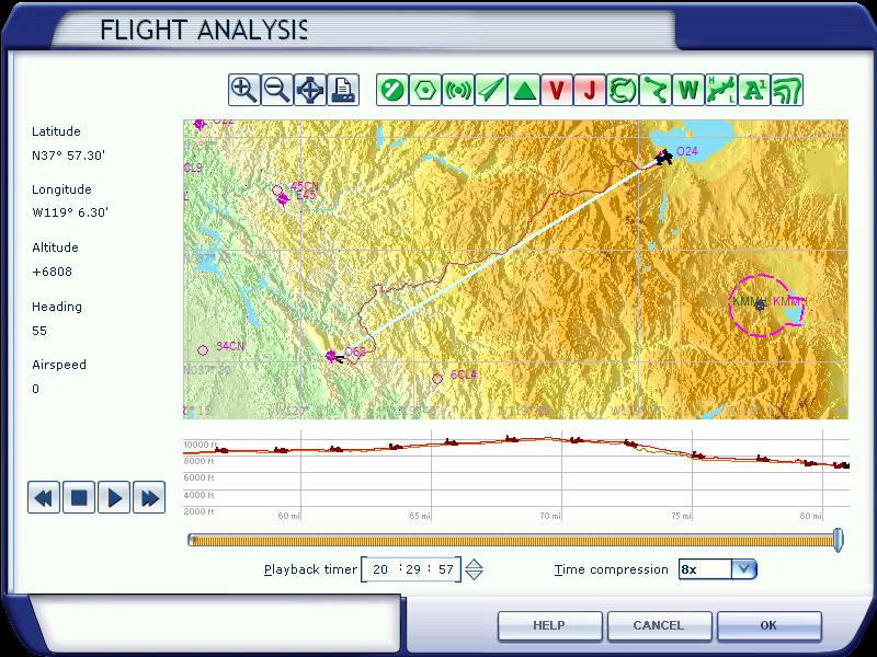
YOSEMITE VALLEY
Mariposa-Yosemite (O68) Rwy08 → Mariposa → 140 → Yosemite Valley → Olmsted Point → Tioga Road → Lee Vining (O24) Rwy32
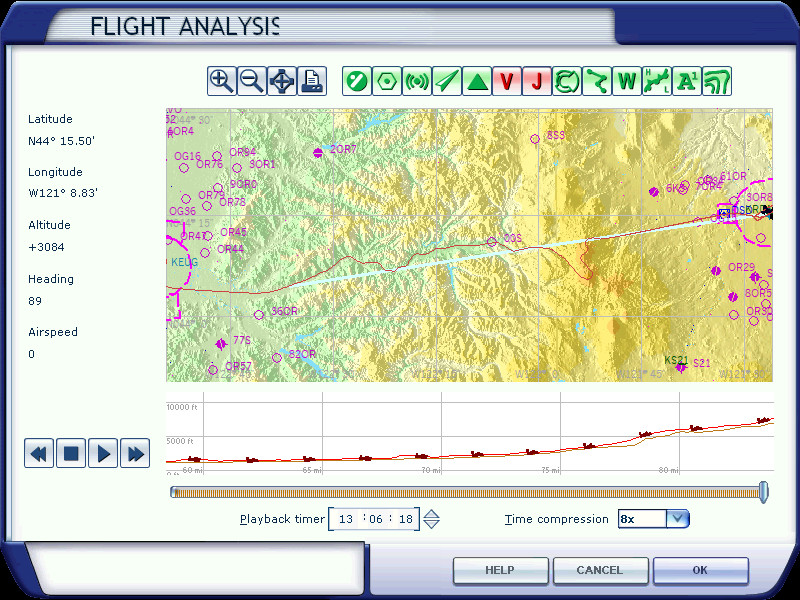
MCKENZIE VALLEY
Mahlon Sweet (KEUG) Rwy16 → McKenzie River → McKenzie Bridge (00S) → Three Sisters → Roberts (KRDM) Rwy04
ARTHURS PASS
Greymouth (NZGM) Rwy01 → Lake Brunner → SH73 → Arthurs Pass → Waimakariri River → Craigieburn → Christchurch (NZCH) Rwy02
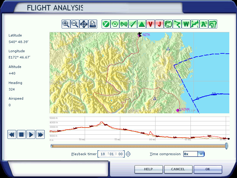
NELSON-TAKAKA
Nelson (NZNS) Rwy02 → Motueka (NZMK) → SH60 → Sam's Creek → Cobb Reservoir → Cobb Hut → Waingaro Forks Hut → Lake Stanley → Anatoki Forks Hut → Anatoki River → Takaka (NZTK) Rwy36
MACH LOOP
Llanbedr (EGOD) Rwy18 → Machynlleth → A489 → A470 → A487 → Machynlleth → Llanbedr (EGOD) Rwy36
LAKE DISTRICT (LFA17) WEST
Walney Island (EGNL) Rwy06 → Windermere → Thirlmere → Bassenthwaite Lake → Carlisle (EGNC) Rwy07
LAKE DISTRICT (LFA17) EAST
Walney Island (EGNL) Rwy06 → Windermere → Kirkstone Pass → Ullswater → Carlisle (EGNC) Rwy07
SCOTTISH LOCHS
Leuchars (EGQL) Rwy09 → Forfar → Braemar → Loch Tummel → Loch Rannoch → Loch Ericht → Loch Ness → Inverness (EGPE) → Kinloss (EGQK) → Lossiemouth (EGQS) Rwy05
SWISS ALPS
Basle-Mulhouse (LFSB) Rwy16 → Grenchen (LSZG) → Bern (LSZB) → Thun (LSZW) → Interlaken (LSMI) → Meiringen (LSMM) → Ulrichen (LSMC) → SS659 → E62 → Lago Maggiore → Malpensa (LIMC) Rwy35L
GRAND CANYON WEST
Nellis (KLSV) Rwy21L → Lake Las Vegas → Colorado River → Temple Bar (U30) → Peach Springs (1G4) → Grand Canyon → Grand Canyon National Park (KGCN) Rwy21
GRAND CANYON EAST
Grand Canyon National Park (KGCN) Rwy03 → Grand Canyon → Marble Canyon (L41) Rwy03
PORTLAND LOOP
Portland (KPDX) Rwy10L → Columbia River → Cascade Locks (KCZK) → Carson → Wind River Hwy → Swift Reservoir → Yale Lake → Lake Merwin → Woodland (W27) → Portland (KPDX) Rwy10R
SEATTLE I90
Seattle-Tacoma (KSEA) Rwy34R → I90 → Bandera (4W0) → Easton (KESW) → Cle Elum (S93) → De Vere (2W1) → Bowers (KELN) Rwy07
VANCOUVER WEST LOOP
Vancouver (CYVR) Rwy26L → Squamish (CYSE) → Pemberton (CYPS) → Lillooet Lake → Tipella (CBB7) → Harrison Lake → Chilliwack (CYCW) → Vancouver (CYVR) Rwy26R
VANCOUVER EAST LOOP
Chilliwack (CYCW) Rwy07 → Hope (CYHE) → Lytton (CYLY) → Lillooet (CAR3) → Seton Lake → Anderson Lake → Pemberton (CYPS) → Lillooet Lake → Tipella (CBBY) → Harrison Lake → Chilliwack (CYCW) Rwy07
YOSEMITE VALLEY
Mariposa-Yosemite (O68) Rwy08 → Mariposa → 140 → Yosemite Valley → Olmsted Point → Tioga Road → Lee Vining (O24) Rwy32
MCKENZIE VALLEY
Mahlon Sweet (KEUG) Rwy16 → McKenzie River → McKenzie Bridge (00S) → Three Sisters → Roberts (KRDM) Rwy04
ARTHURS PASS
Greymouth (NZGM) Rwy01 → Lake Brunner → SH73 → Arthurs Pass → Waimakariri River → Craigieburn → Christchurch (NZCH) Rwy02
NELSON-TAKAKA
Nelson (NZNS) Rwy02 → Motueka (NZMK) → SH60 → Sam's Creek → Cobb Reservoir → Cobb Hut → Waingaro Forks Hut → Lake Stanley → Anatoki Forks Hut → Anatoki River → Takaka (NZTK) Rwy36
Last edited:

") albeit, do not spend too much time fiddling with the scenery though! and turn off the GPS; fly instead with visual scenery markers/checkpoints and ground based navaids
albeit, do not spend too much time fiddling with the scenery though! and turn off the GPS; fly instead with visual scenery markers/checkpoints and ground based navaids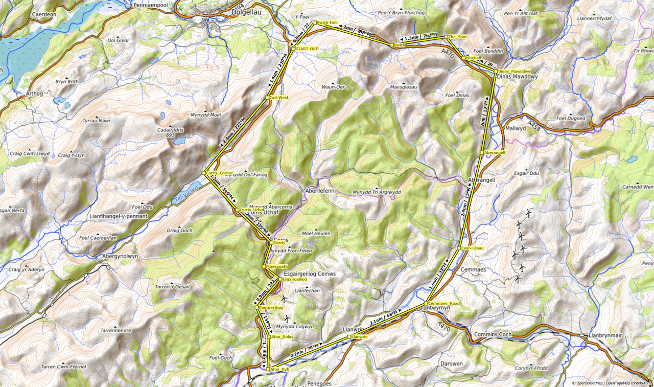
.jpg)