-
Please see the most recent updates in the "Where did the .com name go?" thread. Posts number 16 and 17.
-
IMPORTANT DOWNLOADING INFORMATION - ALL MEMBERS PLEASE READ
Please see this thread for updates. Update Thread
SOH ADMINISTRATION
You are using an out of date browser. It may not display this or other websites correctly.
You should upgrade or use an alternative browser.
You should upgrade or use an alternative browser.
Screenshots
- Thread starter kdriver
- Start date
Shadow Wolf 07
SOH-CM-2025
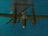
Nice shots! 
UncleTgt
SOH-CM-2026
Back from vacation, suitably refreshed/jetlagged (delete as appropriate).
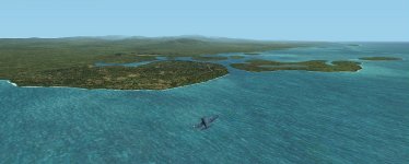
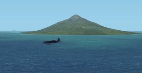
Back at the coalface in PNG, I'm finally getting to the Madang area...
Back at the coalface in PNG, I'm finally getting to the Madang area...
Attachments


Shadow Wolf 07
SOH-CM-2025
Nice work UT, nice work! 
UncleTgt
SOH-CM-2026
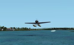
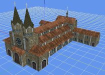
Working my way northwards from Madang. Next up are the 2 airstrips at Alexishafen, Danip (pre-war), & 1943's Alexishafen II.I decided the Cathedral object needed making with GMax. This landmark was destroyed by Allied bombers in early 1944 after the Japs began using it to store munitions. It was never rebuilt.
Attachments

UncleTgt
SOH-CM-2026
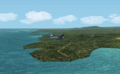
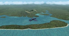
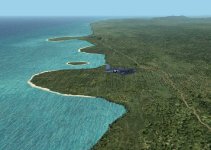
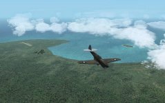
A look around Hansa Bay ...
Attachments


UncleTgt
SOH-CM-2026
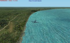
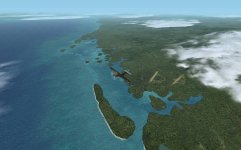
The next scenery pack is almost ready for release.
This extends along the northern coast of PNG from where previous Houn Gulf package ended, just north of Finschhafen, & gets you as far west as Hansa Bay.
This extends along the northern coast of PNG from where previous Houn Gulf package ended, just north of Finschhafen, & gets you as far west as Hansa Bay.
Attachments
UncleTgt
SOH-CM-2026
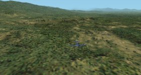
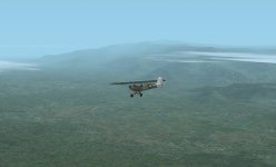
Some of the pre-war landing grounds of the Eastern Highlands will be included. Although of limited use in a Combat Sim, they have interesting histories, & some should be just as challenging as landing back on a pitching & rolling carrier deck ...
For example,
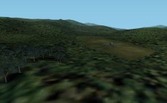
I'll include the strip at Aiyura. The Australian Army Terrain study called this strip "a death trap", only suitable for lightly loaded DH Dragon or similar. Situated in a bowl shaped valley, the runway was ringed by tree cover. It had a hill at the SE end, & was only used uphill, towards this hill! The location was also reported to be susceptible to cross winds
For example,
I'll include the strip at Aiyura. The Australian Army Terrain study called this strip "a death trap", only suitable for lightly loaded DH Dragon or similar. Situated in a bowl shaped valley, the runway was ringed by tree cover. It had a hill at the SE end, & was only used uphill, towards this hill! The location was also reported to be susceptible to cross winds
Attachments
UncleTgt
SOH-CM-2026
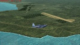
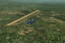
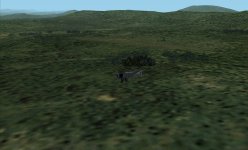
SW of Madang we have the landing ground at Amele.
Built close to the river, its short grass runway had an approach over trees & hill escarpments to its East.
The runway was spongy, with potholes covering the SW end of the clearing, so the Australians quickly determined it completely useless for operations, even by light aircraft...
Built close to the river, its short grass runway had an approach over trees & hill escarpments to its East.
The runway was spongy, with potholes covering the SW end of the clearing, so the Australians quickly determined it completely useless for operations, even by light aircraft...
